Many people are fascinated with maps, and historical maps, which show how earlier generations conceptualized their world and the things that were important to them, are among the most fascinating of all. However, the recent upsurge of interest in maps speaks to something important for genealogists. As part of the attempt to overcome the Cartesian division between the material world and the mind, we now talk about the "embodied self". This is also true, though, about family history, as all family history happens somewhere. Here it might be better to talk about "embedded families" - families which are embedded in communities, and family history which is intertwined with local history. The mapping of our communities is, therefore, emerging as one of the new pivots of heritage societies.
Working on the Project
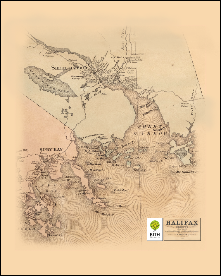
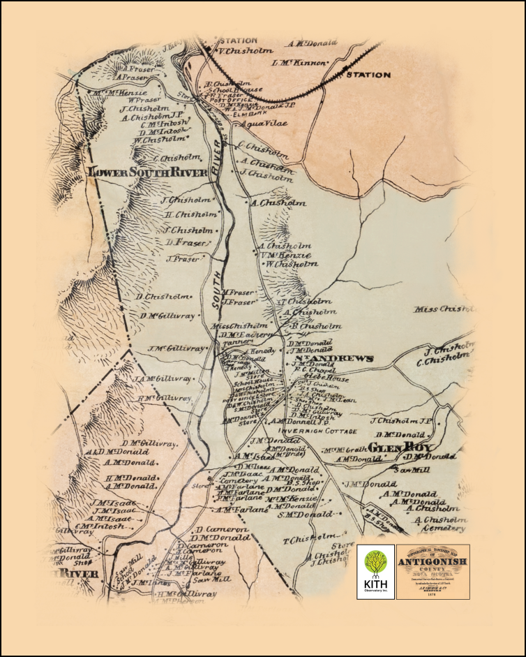
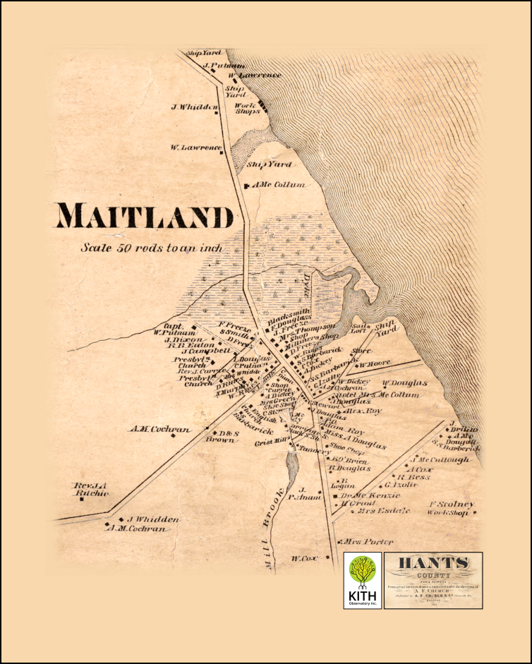
In 2019, GANS became part of a joint venture with three other continuing heritage groups in work on the A. F. Church maps. Between 1864 and 1888, Ambrose Finson Church, a transplanted Maine cartographer, conducted large-scale topographical mapping of each of the eighteen counties of Nova Scotia. Apart from his efforts to map the roads and waterways, and the external coast, coves and inlets, Mr. Church also pinpointed the dwellings of residents, writing the first initial and surname of the principal family member in the empty spaces. In 1881, there were 74,154 dwellings in the province and, when properly digitized and geo-referenced, precise latitudes and longitudes can be calculated for essentially all of those dwellings. The practical goal has been set as transcribing the names on the map, and matching them to census information.
The job is not straight-forward. The maps were printed as lithographs, typically in four sections, matched and glued together on a linen blacking. The maps range in age now between about 140 years and 170 years of age, and are all degraded in some respects, often with pieces having fallen off, or having become stained from water damage, or cracked and broken. The physical conservation of the maps is, therefore, the first job. Digitization also has its own problems. We have used an overhead camera for the work we have done, splicing together multiple small images to reduce focal distortion. At 600 dpi, the combined image file for one map range between 5GB and 6GB in size, requiring serious computing power for edits. Working with the much more accurate geographies we have now, the geo-referencing of these older maps has led to the creation of between 300 and 500 anchor points per county to micro-anchor the maps to contemporary spatial systems.
Experiments with Matching the Maps
We have, however, done some successful experiments with matching the dwelling points on the A. F. Church maps with census information. Here are two test results for a simple census match: Heatherton Antigonish County, or New Ross, Lunenburg County. You will have to adjust the "Map Background" dropdown in the top left corner to find the "Satellite" image in order to see the A. F. Church map.
Further work is focussed now on software development, a job which has presented considerable challenges. Progress is slow, but steady. In the meantime, we are moving ahead in the Spring of 2024 with physical conservation of three further county maps - Queens County, Shelburne County, and Guysborough County.
This Project has a high level of difficulty and is very capital intensive, but work continues.